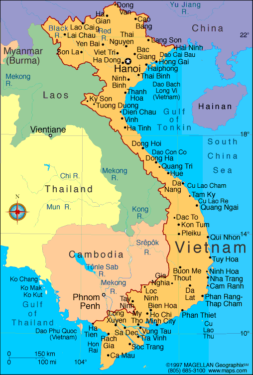
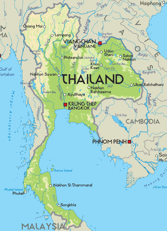
Thursday, March 17, 2011

national enthem


vietnam


thailand


SOME VIDEO ABOUT THAILAND AND VIETNAM


THAILAND


VIETNAM


Vietnam Natural resources

Natural resources: phosphates, coal, manganese, rare earth elements, bauxite, chromate, offshore oil and gas deposits, timber, hydropower

Natural Resources
Oil and Gas
Vietnam’s potential crude oil reserves in the southern offshore area stand at about 270 million tons and are likely to increase substantially with continued exploration.
Vietnam has potential non-associated gas reserves of more than 360 billion cubic meters. Proven associated gas reserves are on the order of 57 billion cubic meters.
Mineral Resources
Vietnam’s primary coal resource, anthracite, is concentrated in Quang Ninh Province in the Northeast. It has potential recoverable reserves of 7-8 billion tons of which 600 million tons are shallow (within a depth of 100 meters). The country also has an abundance of other minerals, including bauxite, iron ore, copper, gold, precious stones, tin, chromate, apatite, and building materials such as granite, marble, clay, silica sand, and graphite.
Other Resources
Vietnam is also very rich in other natural resources including significant hydropower (10,000 MW), marine resources, tropical forest, and agricultural potential. The country has 4 world heritages recognized by UNESCO, beautiful beaches, national ecologic forests, countryside, high-land and historic places.


Thailand Natural resources

Natural resources: tin, rubber, natural gas, tungsten, tantalum, timber, lead, fish, gypsum, lignite, fluorite, arable land
What natural resources would you find in Thailand?

According to the CIA World Factbook 2002, the following natural resources are found in Thailand: 

tin, rubber, natural gas, tungsten, tantalum, timber, lead, fish, gypsum, lignite, fluorite, arable land.
 

In addition, the following are Thailand's leading agricultural exports:
 

rice, cassava (tapioca), rubber, corn, sugarcane, coconuts, soybeans.


CLIMATE OF VIETNAM

Vietnam occupies a land area of 330,000 sq. km. and measures 1,650 km from its northern border with China to its southernmost tip at the Eastern Sea. Situated in the heart of Southeast Asia, with 3,260 km of spectacular coastline, Vietnam offers ideal advantages for economic development, trade and tourism.

Geography and Climate
Vietnam occupies a land area of 330,000 sq. km. and measures 1,650 km from its northern border with China to its southernmost tip at the Eastern Sea. Situated in the heart of Southeast Asia, with 3,260 km of spectacular coastline, Vietnam offers ideal advantages for economic development, trade and tourism.
Mountains and tropical forest cover three quarters of Vietnam, but the flatlands make up the most heavily populated portion of the country. The country’s two “rice bowls” lie in the Red River delta in the North and the Mekong River delta in the South.
Hanoi, the nation’s capital, lies on the banks of the Red River. It is not only the country’s political, cultural and educational capital but also the most important economic center in the North. Ho Chi Minh City, the new name for Saigon, lies just north of the Mekong Delta in the South, and is the largest city in Vietnam. The city, with a population of five million, functions as the country’s economic heart and business hub. Danang, in the central part of the country, is the third largest city and an important port.
Vietnam has two climates. The southern and central regions have a tropical climate with dry and rainy seasons and are normally humid throughout the year. In the north, the four seasons, including a distinct winter, are more defined. Average annual rainfall is about 223 cm.


CLIMATE OF THAILAND

Thailand has a warm, tropical climate affected by an annual monsoon, with a rainy season from June to October and a dry season the rest of the year. Temperatures average 75 to 92 degrees Fahrenheit, with the highest temperatures from March to May and the lowest in December and January.
Tropical, rainy, warm, cloudy southwest monsoon from mid-May to September. Dry, cool northeast monsoon from November to mid-March, southern isthmus always hot and humid.
There are three seasons: the cool season (November to February), the hot season (April to May), and the rainy season (June to October), though downpours rarely last more than a couple of hours.

Thailand's climate is tropical, high both in temperature and humidity, and dominated by monsoons. April and May are the hottest months of the year, when even the locals are moved to complain about the heat. June sees the beginning of the South West Monsoon, and brings with it the rainy season, which continues intermittently until the end of October.
From November to the end of February the climate is much less trying with a cooling North East breeze and a reduction in the humidity level. This is also the main tourist season, and the best time to visit Thailand.
The north and north-east are generally cooler than Bangkok in winter, and hotter in summer. In the far north, around Mae Hong Son temperatures can occasionally drop as low as 2oC.


Geography of Vietnam

Vietnam


Vietnam is located on the eastern margin of the Indochinese peninsula and occupies about 331,688 square kilometers, of which about 25 % was under cultivation in 1987. It borders the Gulf of Thailand, Gulf of Tonkin, and South China Sea, alongside China, Laos, and Cambodia. The S-shaped country has a north-to-south distance of 1,650 kilometers and is about 50 kilometers wide at the narrowest point. With a coastline of 3,260 kilometers, excluding islands, Vietnam claims 12 nautical miles (22.2 km; 13.8 mi) as the limit of its territorial waters, an additional 12 nautical miles (22.2 km; 13.8 mi) as a contiguous customs and security zone, and 200 nautical miles (370.4 km; 230.2 mi) as an exclusive economic zone.
The boundary with Laos, settled, on an ethnic basis, between the rulers of Vietnam and Laos in the mid-seventeenth century, was formally defined by a delimitation treaty signed in 1977 and retified in 1986. The frontier with Cambodia, defined at the time of French annexation of the western part of the Mekong River Deltain 1867, remained essentially unchanged, according to Hanoi, until some unresolved border issues were finally settled in the 1982-85 period. The land and sea boundary with China, delineated under the France-China treaties of 1887 and 1895, is "the frontier line" accepted by Hanoi that China agreed in 1957- 58 to respect. However, in February 1979, following China's limited invasion of Vietnam, Hanoi complained that from 1957 onward China had provoked numerous border incidents as part of its anti-Vietnam policy and expansionistdesigns in Southeast Asia. Among the territorial infringements cited was the Chinese occupation in January 1974 of the Paracel Islands, claimed by both countries in a dispute left unresolved in the 1980s.


Vietnam Geography
Located in the southeastern extremity of the Indochinese peninsula, Vietnam spreads over an area of about 331,690 sq.kms. Vietnam shares a border with the Gulf of Tonkin, Gulf of Thailand, South China Sea alongside China, Laos and Cambodia. What makes Vietnam Geography remarkable is its S-shaped coastline that runs for as long as 3,260 kilometers.
Geography of Vietnam can be divided in to four sections that range from rugged mountains to marshy fertile flatlands. Towards the south lies the Gulf of Thailand, towards the east and southeast lies the Red River Delta. China lies towards the north then there are mountains extending up to 3.143 m at Fan Si Pan, which is also know as the highest point in Vietnam.
Tropical lowlands, hills, densely forested highlands and deltas are some of the major geographical features of Vietnam. The Red River Delta is a triangular region covering 3,000 sq,kms and is densely populated than the Mekong River Delta. Owing to its low level which is just 3 km above sea level, the entire delta region is subject to frequent flooding.
Vietnam enjoys a varied climate. The weather in Vietnam is controlled by two monsoons, one of them is the dry monsoon and the other is the wet one. In the north the average temperature extends up to 27 degrees C and 21 degrees C in the south. Avoid traveling to Vietnam during from July to August, which is the hottest and the most humid period in Vietnam. The annual rainfall received in Vietnam ranges from 1200 centimeters to 300 centimeters.
Best Time to Visit Vietnam: Traveling to Vietnam can be enjoyed all round the year, however as mentioned before, one should avoid traveling to Vietnam between June to August, which is the wet season and is considered as the hottest and the most humid period of the year. Hanoi Sightseeing in Vietnam can be best enjoyed between December to February, when the north Vietnam tends to be cool and often misty.


Demographics of Thailand
From Wikipedia, the free encyclopedia

This article is about the demographic features of the population of Thailand, including population density, ethnicity, education level, health of the populace, economic status, religious affiliations and other aspects of the population.
Thailand's population is relatively homogeneous, however, this is changing due to immigration. More than 85% speak a Tai language and share a common culture. This core population includes the central Thai (33.7% of the population, including Bangkok's population), Northeastern Thai or Lao (34.2%), northern Thai (18.8%), and southern Thai (13.3%).
The language of the central Thai population is the educational language and administrative language. Several other small Tai groups include the Shan, Lue, andPhutai.
Up to 14% of Thailand's population are of Chinese descent, but the Sino-Thai community is the best integrated in Southeast Asia. Malay and Yawi-speaking Muslims of the south comprise another significant minority group (2.3%). Other groups include the Khmer; the Mon, who are substantially assimilated with the Thai; and the Vietnamese. Smaller mountain-dwelling tribes, such as the Hmong and Mein, as well as the Karen, number about 788,024. Some 300,000 Hmong, who ironically have lived this area for more generations than the Thais themselves, are to receive citizenship by 2010.[citation needed]
Thailand is also home to a significant number[quantify] of registered foreigners from Asia, Europe, and North America, as well as an estimated several hundred thousand illegal immigrants, some of which are natives. Increasing numbers of migrants from Burma, Laos, and Cambodia as well as nations such as Nepal, India, along with those from the West and Japan have pushed the number of non-nationals residing in Thailand to close to 2 million in 2008, up from about 1.3 million in the year 2000. A rising awareness of minorities is slowly changing attitudes in a country where non-nationals, some having resided in what is now Thailand longer than the Thais themselves, are barred from numerous privileges ranging from healthcare, ownership of property, or schooling in their own language.
The population is mostly rural, concentrated in the rice-growing areas of the central, northeastern, and northern regions. However, as Thailand continues to industrialize, its urban population - 31.1% of the total population, principally in the Bangkok area - is growing.
Thailand's highly successful government-sponsored family planning program has resulted in a dramatic decline in population growth from 3.1% in 1960 to around 0.4% today. Life expectancy also has risen, a positive reflection of Thailand's efforts in executing public health policies. However, the AIDS epidemic has had a major impact on the Thai population. Today, over 700,000 Thais are HIV or AIDS positive - approximately 2% of adult men and 1.5% of adult women. Every year, 30,000-50,000 Thais die from HIV or AIDS-related causes. Ninety percent of them aged 20–24, the youngest range of the workforce. The situation could have been worse; an aggressive public education campaign in the early 1990s reduced the number of new HIV infections from 150,000 to 25,000 annually.
The 1997 constitution mandated 12 years of free education, however, this is not provided universally. Education accounts for 19% of total government expenditures.
Theravada Buddhism is the official religion of Thailand and is officially the religion of about 97% of its people. However, the true figure lies closer to 85%, Muslims are some 10% and 5% other religions including Christianity, Hinduism, especially among immigrants. In addition to Malay and Yawi speaking Thais and other southerners who are Muslim, the Cham of Cambodia in recent years begun a large scale influx into Thailand. The government permits religious diversity, and other major religions are represented, though there is much social tension, especially in the South. Spirit worship and animism are widely practiced. 

Geography of thailand.

<·          Thailand


     Situated in Southeast Asia, Thailand is predominantly a Buddhist kingdom almost equidistant from India and China. Known by outsiders as Siam for centuries, Thailand (the land of smiles), has been something of a Southeast Asian migratory, cultural, and religious crossroads.
  •    Approximately the size of France, Thailand covers and area of 510,000 sq. km and has a population of 60 million growing at a rate of 1.5% each year. Thailand shares its border with Myanmar in the west and north, Laos in the northeast, Cambodia in the east and Malaysia in the south.
  •   Administratively, the country is divided into 7 regions: The North, Northeast, Central Plains, East, West, and the Bangkok Metropolitan Region. Each of which has its own distinctive geographical character.
  •   The central region, encompassing the Bangkok metropolitan region and the central plains, is affectionately known as "Thailand's Rice Bowl". One of the world's most fertile rice and fruit growing areas, this is the economic and cultural heartland of the Thai nation.
  • The mountainous north is Thailand's largest region. Here, elephants work the forest and winter temperatures are sufficiently cool to permit cultivation of temperate fruits such as strawberries and peaches.
  • The second largest and poorest region is the sprawling northeast. Better known as "Isan" or the "Khorat Plateau", it is largely bordered by the Mekong River, where the world's oldest Bronze Age civilization flourished some 5,000 years ago.
  •  Just south of the northeast lies the eastern region. Sandwiched between the sea and the Damrek range, this is where pristine beaches support the growth of summer resorts such as Pattaya.
  • Despite recent development efforts undertaken by the government in the west, its beautiful mountains, which rise up towards the Burmese border and its lush valleys remain relatively unspoiled. The towns here have a frontier atmosphere.
  • Last but not least, the peninsular south. Here, arresting scenic beauty complements the economically vital activities of tin mining, rubber cultivation, and fishing.

LOCATIONS, GEOGRAPHY AND CLIMATE IN THAILAND

  • Thailand is the geographical heart of South-East Asia. The infamous golden triangle, located at the nation's northernmost point, is where Thailand's borders meet those of both Laos and Myanmar (Burma). The border with Myanmar continues to the west and then south as far as the Malay peninsula, much of which is occupied by Thailand. On the east, the border with Laos meanders southeast along the Mekong River until it reaches Cambodia, which is due east of Bangkok, the Thai Capital. In the south is the Gulf of Thailand. Roughly the size of France (200,000 sq. miles), Thailand is composed of four main regions. The northern mountainous region contains numerous ruins and temples, the ancient city of Chieng Mai, and Thailand's highest peak, Doi Inthanon. This region is also home to the hill tribes of Thailand, distinct ethnic groups which settled in the area thousands of years ago after migrating from as far away as Tibet and central China. The north-east of Thailand occupies the semi-arid Korat plateau, the most desolate and least-visited part of the country. An interesting blend of Thai, Lao, and Khmer influences characterise the culture of the Korat. Central Thailand, which consists of the fertile plains surrounding the Chao Phraya River, is the country's most populous region and its rice basket. Thailand's alluring and congested capital city of Bangkok is located along the banks of the Chao Phraya, near the river's outlet into the Bight of Bangkok and the Gulf of Thailand. The southern region of Thailand, which stretches for hundreds of miles along the Malay peninsula, abounds with stunning beaches and scores of tropical islands.
  • Thailand can be an extremely hot and soggy place. Its tropical climate is divided into three seasons: cool in November to February, hot in March to May, and rainy in June to October. The seasons are more extreme in the northern regions, where the dry heat can grow quite intense in late spring and the cool can become cold in the mountains. The rainy season is no detriment to travel in Thailand, as the rains can be cool and refreshing.


South East Asia

study case 5 (presentation time) > South East Asia

Indian tourism official video

Pakistan tourism official video

Pakistan National Anthem

Truth about Pakistan

Jana Gana Mana - India National Anthem

Knowledge about India

Pakistan Flag , National Anthem and Father of Nation

Flag of Pakistan
Pakistan Flag
Father of Nation

Quaid-i-Azam

Muhammad Ali Jinnah
Independence Day
14 August 1947
National Anthem

Approved in June, 1954 
Verses Composed by
Hafeez Jullundhri 
Tune Composed by
Ahmed G. Chagla 
Duration
80 seconds

About Pakistan

Introduction
Pakistan is an Islamic Republic (Official name: Islamic Republic of Pakistan) and its capital is Islamabad. Pakistan has four provinces: Baluchistan, North West Frontier Province (NWFP), Punjab and Sindh. Their respective capitals are: Quetta, Peshawar, Lahore andKarachi . In addition to these provinces is the Federally Administered Northern Area (FANA), which is divided into the districts of Diamer, Ghanche, Ghizer, Gilgit and Skardu. There are also seven Federally Administered Tribal Areas. (FATA).

Government
Pakistan has a federal structure. Parliament consists of the Lower House (National Assembly) and the Upper House (Senate). Members of the National Assembly are directly elected and their term of office is five years. The National Assembly determines the major policy issues and passes an annual budget and legislation. It elects the Prime Minister from among its members.
The Prime Minister forms the cabinet from among members of the Assembly and the Senate. Provinces have their own elected legislative assemblies and Chief Ministers. The Provincial Assemblies elect the majority of the members of the Upper House. 
Facts and Figures
The national language is Urdu, while the official language is English. Some of the main regional languages include Sindhi, Baluchi, Punjabi and Pushto.
Pakistan has a Population of over 130 million. At present, the growth rate is 2.8 percent per annum. The major cities are Karachi (10 million),Lahore (5.5 million), Faisalabad (2 million), Rawalpindi (928,000), Islamabad (340,286). Other cities include Peshawar, Quetta, Rawalpindi, Hyderabad, Multan and Sialkot. Major religions are Muslim (97%), Hindu (1.5%), Christian (1%) and several other minorities.
Area
Total Area: 796,095 Sq. Km
  • Punjab Province: 205,344 Sq. Km
  • Sindh Province: 140,914 Sq. Km
  • North West Frontier Province (NWFP): 74,521 Sq. Km
  • Balochistan Province: 347,190 Sq. Km
  • Federally Administered Tribal Areas (FATA): 27,220 Sq. Km
  • Islamabad (Capital): 906 Sq. Km

Map of Pakistan

Map of Pakistan
(Area: 796,095 Sq. Km)
Land Boundaries

Total:
 6,774 km
Afghanistan: 2,430 km
China: 523 km
India: 2,912 km
Iran: 909 km
Transport

Total length of Roads

228,206 km. (approx.)
    Pakistan Railway Network
8,775 km. (approx.)
    Railway Stations
781
Education
Literacy rate is about 55.1% (2004). Some facts about educational institutes are:
  • Primary schools: 150,963
  • Middle schools: 14,595
  • High schools: 9,808
  • Arts & science colleges: 798
  • Professional colleges: 161
  • Universities: 35 (10 in Private sector)
Health
Some basic facts about health facilities are:
  • Hospitals: 830
  • Beds: 86,921
  • Doctors(registered): 74,229
  • Dentists(registered): 2,938
  • Nurses(registered): 22,810
National Flower is Jasmine, other trees include Pine, Oak, Poplar, Deodar, Maple, Mulberry. Some popular animal species are The Pheasant, Leopard, Deer, Ibex, Chinkara, Black buk, Neelgai, Markhor, Marcopolo sheep, Green turtles, River & Sea fish, Crocodile, Water Fowls.
Attractions
Pakistan has large number of beautiful places and attractions to visit. Popular tourist destinations during holiday seasons are like Murree, Quetta, Swat Valley, Hunza, Ziarat, Kaghan, Chitral and Gilgit.

About India

Country Profile 
 
Capital : Delhi
Population :
1,080,264,388 (July 2005)
Area : 
3.3 million sq km
Currency : 
Rupees
 (One Rupees 
=100 paise) 
GDP :
 3.319 trillion
(2004)
Per Capita : 
$3,100
(2004 purchasing power parity)
Form : Sovereign,
Socialist, Secular,
Democratic Republic, Parliamentary
Official Languages :17 major languages,
844 dialects